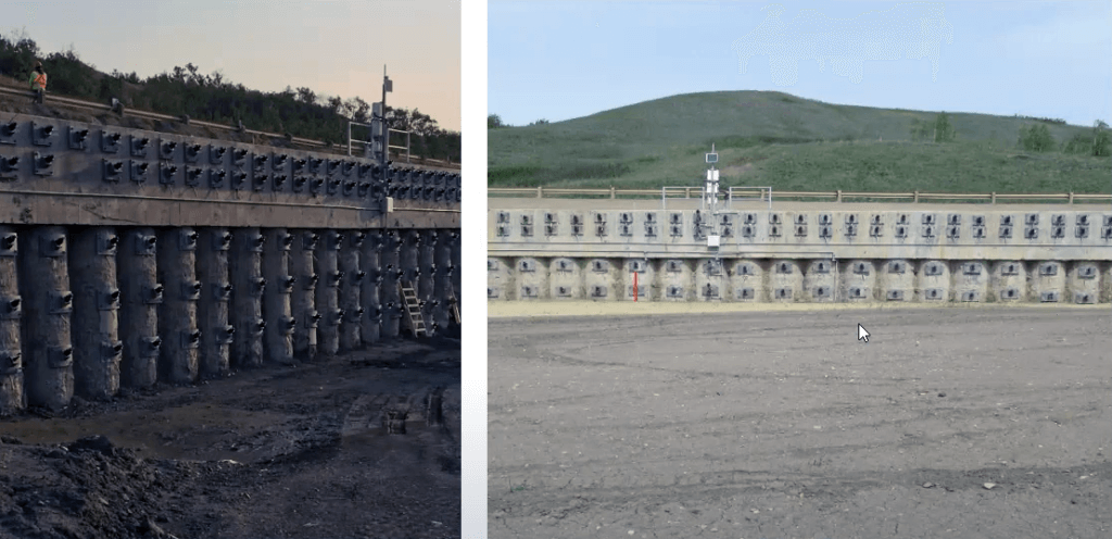
The Peace River region in Northern Alberta is well-known for its complex geology which poses geohazardous risk to roadway and railway transportation infrastructure.
In this seminar video presentation, Leanne McLaren, a graduate student in the Master of Engineering program at the University of Alberta and geotechnical engineer at Thurber Engineering, details her research project. Her work is an analysis of geotechnical data collected before, during, and after a transportation infrastructure remediation project to stabilize a slope embankment along a stretch of Highway 2 in the Peace River region of Alberta.
In “Using Instrumentation Data to Assess the Performance of a Tied-Back Secant Pile Wall” we learn the goal of the project was to use instrumentation data to evaluate the effects of a secant pile wall on soil movement around the highway. This information is important because it directly addresses the causes of threats to the road’s structural integrity.
When Highway 2 was initially constructed in 1956, a section in the Peace River region passed over a particularly landslide-prone area. After it was built, slope movement quickly caused the road to drop several meters, leading to structural problems. As a result, the highway was realigned to avoid the terrain with the largest amount of expected movement.
Even after the realignment, slope movement continued to affect the highway. Since the 1990s, maximum yearly deflection in the ground around the site reached as much as 87 millimetres per year, demonstrating the major structural problems that still existed in the area. In 1998 a cantilever wall was constructed downslope of the highway in an effort to slow its descent. However, this wall was not able to sufficiently stabilize the terrain, and multiple cracks and dips formed in the highway due to a lack of support downslope.
In order to determine the scope of the danger posed by the continuing structural stresses placed on the road, multiple geotechnical investigations were carried out to evaluate soil conditions along the slope. These investigations revealed a slip surface located between a layer of medium-to-high-plastic lacustrine clay lying at a depth of between 6 and 17 metres below the surface and the stiff clay till underneath. Additionally, the water table was found to lie about 9 to 10 metres above the slip surface, which could accelerate weathering. This weathering would lead to the breakdown of cementation and a loss of cohesion.
Because of the unstable ground conditions discovered by the geotechnical investigations, an additional wall was built to protect the highway from slope movement. A tied-back secant pile wall was built between 2015 and 2017 to resist the slip surface. It was created in six separate sections of varying depth with five rows of soil anchors to limit the degree of deflection as much as possible.

McLaren’s project used instrumentation data taken from the ground around the new wall to observe movement and verify design parameters. Instrumentation used before and during construction as part of the observational method included:
Data from these instruments show that the secant pile wall has provided the necessary added support against slope movement along Highway 2. After the wall’s completion, slope movement and deflections decreased. While the reinforcement is not perfect, current stresses are still significantly below the highway’s serviceability limit.
As slope movement beneath the highway continues to occur as expected, it is important to monitor the readings in case further intervention is needed to address the displacement. However, the data shows that the secant pile wall has been effective at keeping the highway serviceable. The instrumentation used in this project could be applied to similar situations throughout the highway system.
Leanne McLaren is a Geotechnical Engineer with Thurber Engineering in Edmonton, Alberta. Her technical interests include slope stability remediation, instrumentation, and foundation design. Outside of work, Leanne is passionate about promoting women and young professionals in engineering and has been an active participant with the Canadian Geotechnical Society as a member of the GeoVirtual and GeoCalgary conference organizing committees and the Southern Alberta Regional Director from September 2017 to December 2020. Leanne is also a singer and songwriter who enjoys horseback riding and ATVing around Alberta.